
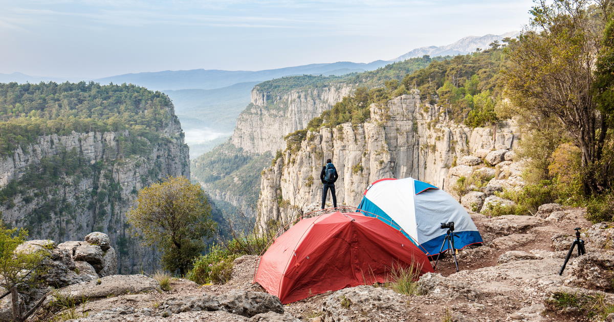
Antalya is filled with beautiful landscapes including beaches but also mountains, valleys, lakes, canyons and beautiful protected national parks. Obviously, all this nature is a great ground for hike lovers. However, hiking trails are not easy to find and online ressources are limited.
This is why we created this guide to hiking in the province Antalya in Turkey. It will help you learn about the best hiking trail locations and details about them.
Also read everything about the preparation for hiking, maps, marked ways, accommodation and frequently asked questions about hiking in Turkey.
Let's start with the best trails for hiking in Antalya.
1. Termessos Ancient Ruins

A highlight near Antalya is the hike to the ruins of the ancient city of Termessos at the foot of Mount Solymos. Already Homer mentioned the Solymans in his Iliad, the story of Troy, as brave warriors.
Alexander the Great failed in the siege of the mountain city. He did not want to sacrifice his army to an eagle's nest. Today, Turkey's "Machu Piccu" at 1,500 meters above sea level in Termessos National Park is a wonderful destination for a one-hour hike.
The experience at the end of the hike is the view from the Roman Theater with more than 5,000 seats to the mountains of the Taurus Mountains.
Discover more information about Termessos Ancient Site
2. Yanartas-Chimaira

About 70 kilometers southwest of Antalya near Çıralı, a millennium-old natural phenomenon can be observed. In several places flames emerge from the rocky mountainside, also called the "eternal fires of Chimaira".
The fire fields are located 2 kilometers from the sea 250 meters above the coast. From the café it takes 30 minutes to reach the first flames and about 60 minutes to reach the last flames on the hill.
Read more about the fires of Chimaira Yanartas
3. Lycian Way

Cultural routes are hiking trails that follow old trade routes or the footsteps of famous travelers. The best known is the 509-kilometer Likya Yolu, which runs from Fethiye to Antalya and is an option for experienced hikers.
The trail leads along sights such as the ruins of the UNESCO World Heritage Site of Xanthos, Myra and the cliffs of the Lycian Coast to Antalya.
Of course, partial routes can also be hiked. For guests in the area around Patara, Kalkan or Kaş, the 16-kilometer section that leads from the ruins of Pydnai via the remains of Letoon to the excavation site of Xanthos in five hours without any significant climbs is just as interesting as the route that leads from the ruins of Phellos at an altitude of 860 meters, partly steeply downhill to Kaş.
On the entire Lycian Way there are numerous other part routes that can be hiked.
Read more with our complete guide of Lycian Way Hiking Trail that informs you about location, trails and special tips.
4. Paulus Way

The Paulus Way, another cultural route with very demanding and strenuous sections, is considered the second oldest hiking trail in Turkey with a length of 500 kilometers.
It begins in Perge, 10 kilometers east of Antalya, and follows the footsteps of the Apostle Paul to the ancient site of Antioch near Yalvaç in the northeast of Lake Eğirdir. The trail leads to altitudes of up to 2,200 meters. Partial stretches can be hiked.
5. Alanya City Centre to Syedra

Seydra used to be an ancient city whose first literary mentions date back to the middle of the 1st century BC. On a high hilltop off the coast lie the ruins of the city, which you enter through the well-preserved monumental gate to the west. Perhaps you will visit one of the two caves, the Cistern Cave and the Baptistery Cave, whose walls are decorated with frescoes from the early Christian period.
From the top of the mountain there is a fantastic view of the whole surrounding countryside. Syedra is located about 18 kilometers from the center of Alanya, the hike takes about 3 hours.
Read more details about Syedra Ancient Site
More Ancient City Ruins in Antalya
Here are other things to do in Alanya
6. Hiking in the Mountains in Ormana

The village of Ormana is located in the foothills of the Taurus Mountains about 60 kilometers from Manavgat and is famous for its button houses built only of stone and boards without nails and cement.
There are several hiking routes from here, including the 11-kilometer trail to Altinbesik Cave. Maybe you would like to go mushroom picking in the mountains, the morel, the second most expensive edible mushroom in the world after the truffle? If you are lucky, you will also see some wild horses.
More sports to do in Antalya's nature
7. Hiking in Kas

In Kaş there are numerous options for hiking, in total the area has 38 hiking trails. One of them is the 9.6 kilometer long trail that leads from Kaş to Limangazı Bay, which can only be reached by boat or on foot.
It takes about 2.5 hours to walk this distance. Another option is a circular walk between two bays, which covers a total of 15 kilometers and takes about 6 hours. In addition, sections of the Lycian Way can be hiked from Kaş.
On the routes the hikers pass ancient ruins and old houses, always accompanied by the breathtaking views of the coast.
Discover the best things to do in Kas
Discover more 100+ things to do in Antalya
8. Tazi (Eagles Canyon)
 in Antalya in Turkey")
Tazı Canyon, also called Eagles Canyon, is located within Köprülü Canyon only 10 kilometers from the rafting center of Köprülü Canyon Nature Park. It is a natural canyon formed by streams. To get there you have to hike about 11 kilometers through the steep rocks in the high mountains, finally being rewarded with a fantastic view.
The area is rich in flora and fauna, animals such as wild boar, deer, fox, wolf, badger, rabbit, lynx and snakes live here. If you are lucky, you can even see golden eagles or buzzards. On the sides of the canyon, a dense and flowering forest offers a picturesque view.
In recent years, Tazi Canyon has become a popular Instagram subject. Particularly in demand are the pictures with the large boulders that border the 300-meter-high cliffs. But be careful, weeds grow on the rocks, making them very slippery in some parts.
By the way, Tazı means "greyhound" in English and not "eagle"...
Here is our complete Guide of Tazi Canyon
Full article about Köprülü Canyon in Antalya
More Canyons in Antalya
9. Hiking from Xanthos to Patara

From the archaeological site of Xanthos, which has been a UNESCO World Heritage Site since 1988, a 14-kilometer trail, which is part of the Lycian Trail, leads to Patara.
Here you will also find ruins worth seeing as well as a partly deserted sandy beach. The beach of Patara is closed from mid-June to mid-August, because during this time the hawksbill turtle comes ashore here to lay its eggs.
On the way there are impressive views of Kalkan Bay and the backlands of the Lycian Peninsula. The route takes about 4 hours in total.
Our Guide of Patara Beach in Kas
Check information about Xanthos Ancient Site
Other Beaches in Antalya to discover
10. Olympos Tahtali Mount

Within 10 minutes the red cabins of the cable car go from the beach in Kemer to the Tahtalı mountain, better known as Olympos. The ride up the 2,365-meter mountain takes about 10 minutes, and the panorama is stunning, even the ancient remains of Phaselis can be seen.
From the top of the mountain, in good weather, the view even reaches Alanya. Up here there are numerous opportunities for hiking.
If you want, you can hike directly from Kemer to the mountain. In spring, summer and autumn, the climb to the top is easily doable for guests with good physical condition and the appropriate hiking equipment.
Check our fully detailed article about Olympos Ancient Site
Discover details about Olympos Teleferik (Cable Car)
11. Hiking at Göynük Canyon

Göynük Canyon in Kemer offers hiking and canyoning opportunities for both beginners and experienced climbers. The nature is impressive with a wild river, picturesque waterfalls and an impressive canyon.
On the 3 kilometer long hiking trail that leads to the end of the valley over a steep slope into the gorge, you can hear only the noise of the river, it is not uncommon to see salamanders here. On the highest point of the slope is a viewpoint that offers a breathtaking view of the surroundings.
The end of the trail is marked by a cottage, which stands by a picturesque lake. The trail is about 4 kilometers long and takes 1 hour. Guided hikes with appropriate equipment also approach the canyon itself from here.
Check our dedicated article about the Göynük Canyon in Kemer
Get inspiration with our article about Rafting in Antalya
12. Beycik Village

The cable car ride to the 2,365 meter high Olympos Mountain takes about 10 minutes and offers a breathtaking panorama. From the top starts the 9 kilometer long hiking trail that leads to the village of Beycik, which is located at 800 meters above sea level.
The route takes about 6 hours. A total of 1565 meters of altitude has to be mastered. At the beginning the path is relatively flat, but after about 45 minutes the first steep slope appears. The area here is without trees, but very stony and rocky.
After descending to an altitude of 1500 meters, the area becomes flatter again, the path leads through pine forests, becomes steep again in places until it finally ends in the village of Beycik. On the way there is a mountain cafeteria, which invites you to take a break.
Bookings in Antalya
antalyatouristinformation.com/d is your best partner when it comes to plan your trip in Antalya. For bookings, questions about Antalya trips, group travel, transfers... anything, fell free to reach us.

Frequently Asked Questions about Hiking:
Here are our answers to popular questions about hiking. Please fell free to contact us for further questions about booking, routes and guided hiking tours in Antalya.