Experience
The Complete Guide to
The Lycian Way
If you found yourself on this page, that means you are up for an exploration of the most popular hiking trail on the Mediterranean Coast: The Lycian Way!
The Lycian Way is a trekking route following the traces of the ancient trade route of the Lycians along the Turkish Mediterranean coast.
This path is a creation of a woman named Kate Clow from England in the 1990s. Her idea was to create a 509-kilometer long Lycian Way from Fethiye to Antalya and to connect 18 ancient cities. When she won a competition announced by a Turkish bank with this idea, she got the financial means to implement the plan and immediately started to work on it. It took her two years to complete it.
In 1999, Turkey had its first marked long-distance hiking trail that met international standards. The prestigious British Sunday Times chose the Lycian Way as one of the top ten hiking trails in the world.
Now that we piqued your curiosity, let's discover the information you will need before embarking on this journey...
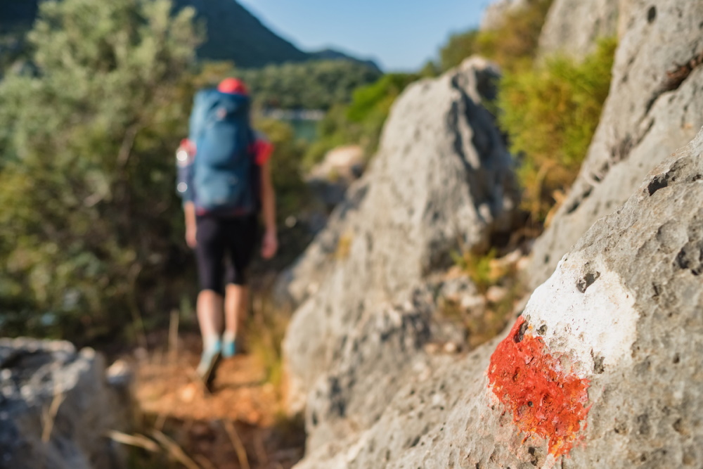
Path Markings on the Lycian Way
All start and end points of the trekking route are marked in larger towns and streets by green, white, yellow, and black signs with location and kilometer information.
The trail itself is marked with red and white lines. Red X warn of wrong turns and saves you from the wrong path.
Since the course of the route is subject to constant changes such as construction work or new paths, it is a great advantage not to count only on the markings, but also to make a GPS comparison in tricky situations.
For this purpose, recommended resources are mentioned at the end of the article.
Best Time for Hiking the Lycian Way
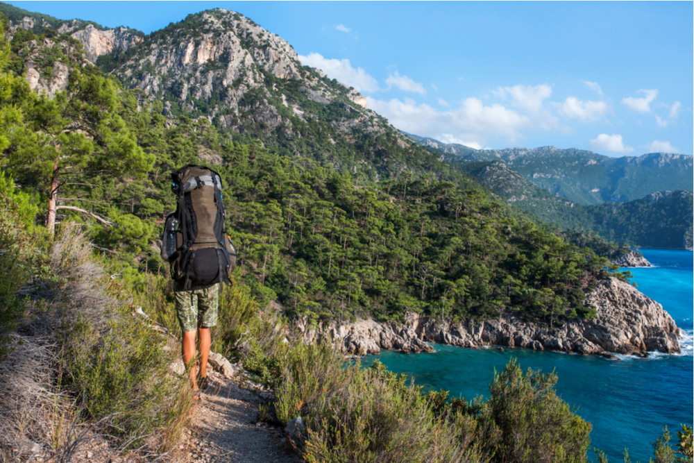
June to August are the hottest months of the year with temperatures some times over 40 degrees Celsius and are not the best time for hiking on this path because the route can be tiring.
In the winter time, it gets uncomfortably cold above certain altitudes and it can snow and become slippery. This would be a time best suited for seasoned hikers only.
So, when is the best time to hike on Lycian Way? Experienced hikers suggest the best time to hike on the Lycian Way is in April and May, and then in September and October. So you have 4 solid months to experience this unique adventure and its easier during these temperate months.
Don't forget that carrying trekking poles, headgear, sun protection, and above all sufficient drinking water is an absolute must!
Solo Hiking on the Lycian Way?
Solo hiking is not recommended on this path. A companion can take care of you or get help in case of an emergency. Besides, hiking in company is much more fun. There are now plenty of offers for guided group hikes on the Lycian Way.
Emergency Numbers
For emergency calls, it makes sense to take a fully charged smartphone with you, even if there is sometimes no signal in the mountains.
Dial 112 to call the emergency doctor, or 115 to call the police. With an appropriate app, a cell phone can also serve as a GPS device.
Necessary Preparation
The Lycian Way is becoming increasingly popular every year.
A growing number of trekking fans from all over the world want to explore this long-distance trail, which is not technically very demanding, but nevertheless sometimes very challenging.
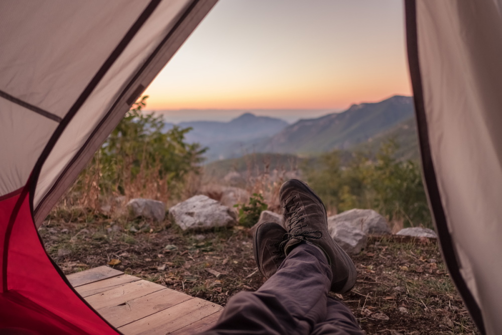
Alpine knowledge is not absolutely necessary, but a good physical condition, as well as a head for heights are absolutely basic requirements to pass here.
The trail frequently goes up and down and in parts is very steep. The path is sometimes very narrow and, it must be said, sometimes much too close to the cliff.
The reward for the effort is, of course, wonderful, unspoiled nature and spectacular panoramic views over the Mediterranean Sea all the way to the horizon.

On the Road
Today, after more than 20 years, Likya Yolu, as the Lycian Way is called in Turkish, has been a well-known name among the locals and has also become a new source of income.
Many inexpensive guesthouses and restaurants have sprung up along the route.
The extremely hospitable people no longer wonder why these strange foreigners are able to afford a plane ticket, but walk around packed like a pack mule.
What makes the Lycian Way appealing to any vacationer in Turkey is the fact that it winds along very close to tourist centers.
Not only with Fethiye and Antalya as starting and ending points, but popular destinations like Kalkan, Kaş, Demre and the coastal strip Kemer, with resorts are a stone's throw away.
Even if you are not an enthusiastic hiker, the Lycian Way is a great day trip full of interesting sights to add some adventure and activity to your beach vacation.
The 4 Sections of the Lycian Way
You don't have to do the whole 509 km long Lycian Way. It is possible to hike along parts of it. Here are four routes with particularly impressive scenery.
1. Starting Point Fethiye
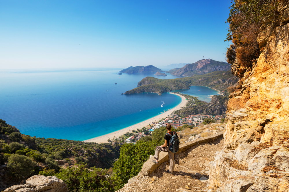
Those staying in the Fethiye area can consider the first stage of the Lycian Way, which leads from Ovacık to Faralya.
The 13.5-kilometer route takes about five hours.
The first half of the way to the village of Kozağacı is steadily uphill with an altitude of over 730 meters, but the magnificent views of Ölüdeniz turquoise lagoon on the Mediterranean Sea and the surrounding countryside quickly make you forget the effort.
Countless paragliders from all over the world come to jump from the nearly 2,000-meter-high Babadağ and make a beautiful picture to the left with the sea to the right. You reach Kozağacı after 6.5 kilometers and Kirme after another 4 kilometers.
In both villages there are small roadside cafés offering refreshments and inviting you to rest. The road then descends in sometimes steep and narrow switchbacks, later turning into a piste and ending in the village of Faralya, perched above the steeply sloping Butterfly Valley (Kelebekler Vadisi).
The sight of this valley, which is a protected nature reserve, and indeed all of the scenery around it, is simply unforgettable. Although a small path leads down to the valley on the eastern side of the apparently vertical wall, it is not necessarily recommended for inexperienced hikers without alpine experience.
.
2. UNESCO World Heritage Sites, 18 kilometers of Sandy Beaches, and a Picturesque Plateau
For visitors to the area around Patara, Kalkan, and Kaş, there are four sections that are particularly beautiful.
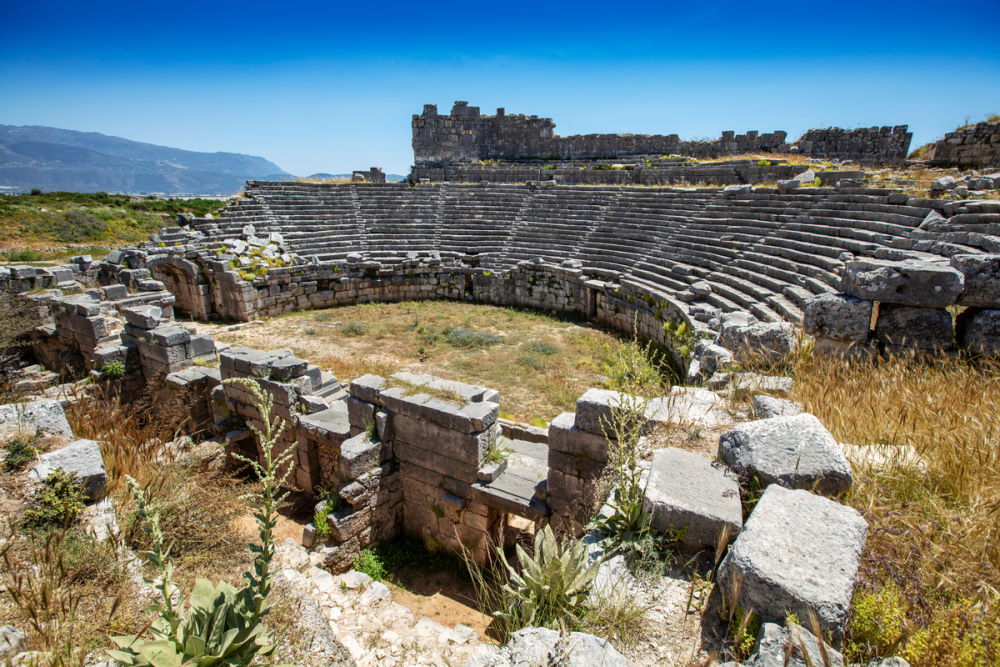
A 16-kilometer section without any notable climbs leads to the ruins of Pydnai via the remains of Letoon to the excavation site of Xanthos and takes five hours from. It is highly recommended, especially for those interested in archaeology.
Letoon and Xanthos have been UNESCO World Cultural Heritage sites since 1988.
Another 14-kilometer section takes you mostly downhill from Akbel to the ruins and the 18-kilometer long, partly deserted sandy beach in Patara in just over four hours.
On the way there are impressive views of the bay of Kalkan and the hinterland of the Lycian Peninsula. The highlight of this hike is certainly a refreshing swim in the Mediterranean Sea.
Patara beach is closed from mid-June to mid-August, because during this time the hawksbill turtle comes ashore here to lay its eggs.
In the third section, 800 sweaty meters of altitude have to be overcome over nine kilometers. The reward is breathtaking views of the Mediterranean Sea stretching to the horizon and the charming Bezirgan plateau.
Another route leads from the ruins of Phellos at an altitude of 860 meters, partly steeply downhill to Kaş. Towards the end of the relatively short 8.5 kilometers section, the panoramic view of the resort on the Mediterranean Sea and the nearby Greek islands will fascinate you.
3. Nicholas Theater and Rock Tombs
On the 18.5-kilometer stretch between Üçağız and Demre, which takes about six hours of pure walking time, several sights await you.
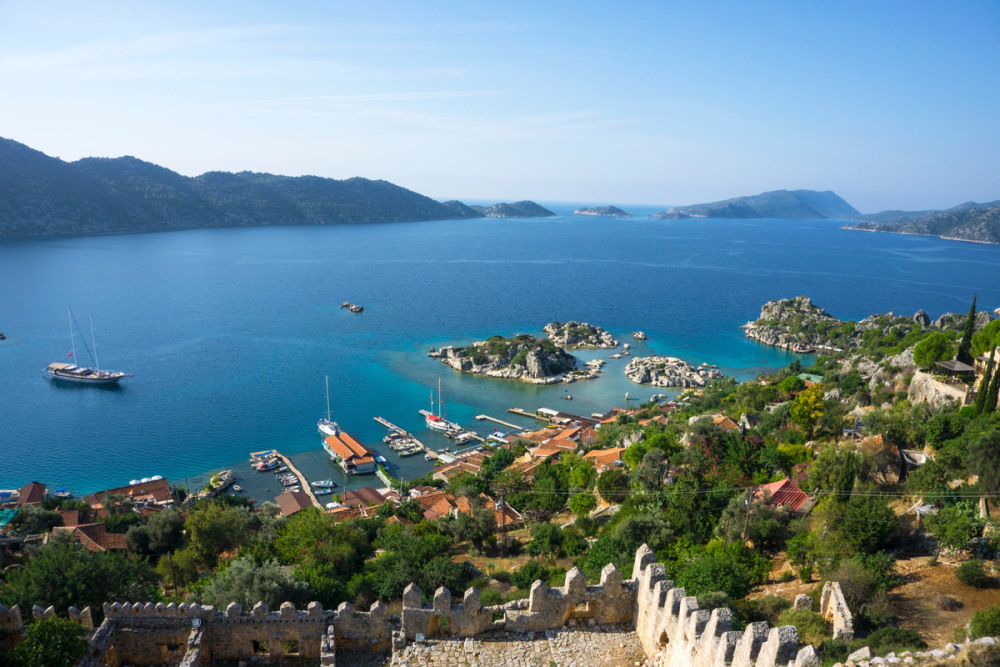
A medieval castle towers above the fishing village of Kaleköy, the former Simena, and a sarcophagus rises out of the water in the middle of the small bay.
Next are the ruins of Andriake, the old port of the ancient city of Myra, today called Demre or Kale.
Without a doubt, the church of St. Nicholas, who was born in Patara around 300 AD and later lived here, as well as the colossal theater and the fascinating rock tombs of Myra are the highlights of this tour and absolutely worth seeing.
4. Eternal Flames, Cable Car Ride, Swimming Next to Ancient Ruins, and a Canyon
Those staying in Antalya or Kemer and its seaside resorts have plenty of choices for a taste of the Lycian Way.
The nearly 15-kilometer, seven-hour section between Adrasan and Çıralı passes the ruins of Olympos and offers plenty of freshening up in the sea.
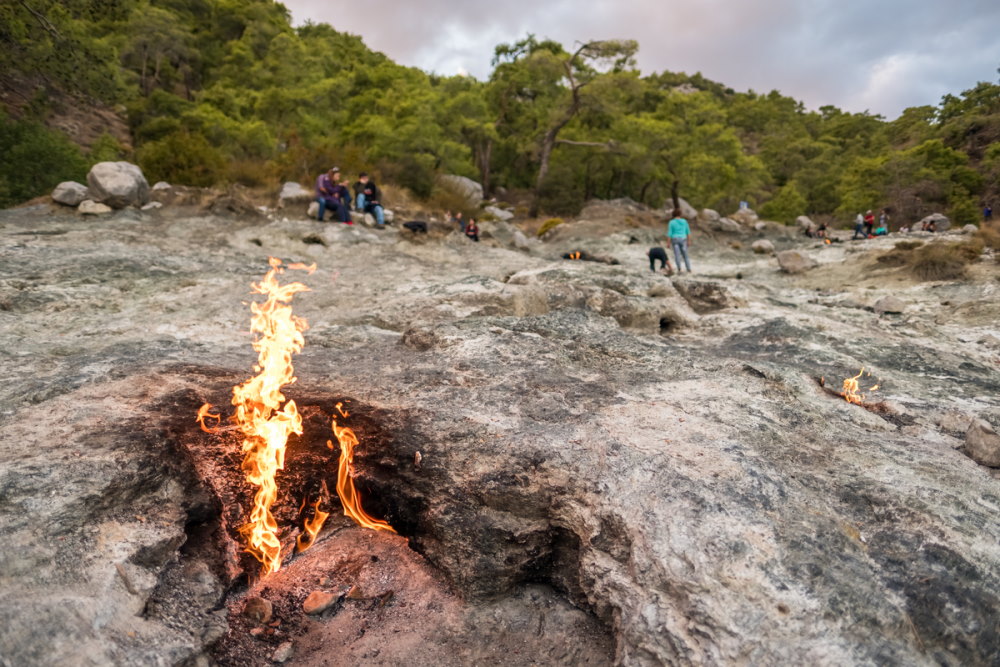
The section from Çıralı in the direction of Ulupınar/Beycik offers a special natural display kilometer 5.5. The Eternal Flames of Chimaira have been burning since ancient times. Documented stories of the flames are more than 2,500 years old.
But it's not a fire-breathing monster, as legend would have us believe. Rather, it is a special natural gas mixture that ignites itself when it comes into contact with air.
The sight of the flames is particularly beautiful after dark. An alternative 14-kilometer coastal route leads to Tekirova in about seven hours. From there, you can take a trip by Dolmuş to the valley station of the Olympos cable car.
The ten-minute ride takes you from 726 meters at the valley station to a high 2,365 meters at Tahlalı Dağ mountain peak. The view from there is simply breathtaking.
Another section can be started in the town of Göynük and ends in Göynük Canyon, about four kilometers away. A high ropes course and opportunities for canyoning offer sporting variety here.
Literature on the Lycian Way
Conrad Stein Verlag's website offers a free download of a GPS track to the guidebooks mentioned below (GPS device or smartphone with app).
Kate Clow – The Lycian Way
The book by the concept founder of the Lycian Way is the standard work for this hike.
Upcountry (Turkey) Ltd. - ISBN 978-0-9539218-6-7
Michael Hennemann - Turkey: Lycian way from Fethiye to Antalya
The guide for hikes along the Lycian Way in German.
Conrad Stein Verlag GmbH - ISBN 978-3-86686-557-0
Maps
Find your way on the Lycian Way with these free online maps that will help you locate yourself.
www.map-site.de
The two topographical hiking maps Lycia West and East on a scale of 1: 50,000 with route and contour lines.
www.opencyclemap.org
Free online maps with contour lines for hikes along the Lycian Way are available here.
www.maps.de
Map sections are available on the website for offline use without the Internet.
Request for Guided Hikes
We are happy to arrange guided group hikes along the Lycian Way.
For individual tours we can arrange a certified local hiking guide.
We are happy help you explore possible the options and can give advice in our first conversation for free.
Continue Reading
Sports, Nature, and Adventure
